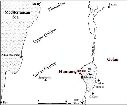
Khirbet Wadi Hamam is a large site (ca. 30–40 dunams) located above Wadi Hamam (Arbel), ca. 2 km west of the Sea of Galilee. A flowing spring right below the site, as well as its proximity to the ancient route that led from the Sea of Galilee through Wadi Arbel to central Galilee and from there to the Mediterranean coast, can explain the development of this large settlement.

Large-scale excavations were conducted at the site by a Hebrew University expedition between 2007 and 2012. The main objectives were (1) to shed new light on the much-debated issue of the dating of “Galilean”-type synagogues; (2) to illuminate the character, communal organization, and economic basis of a Galilean village in the Roman period; (3) to understand better the processes of decline that affected Galilean settlements in the Early Byzantine period; and (4) to date the massive fortification located on Mount Nitai and to determine its purpose and relationship to the village.

The six excavation seasons extended over four areas unearthed some ten residential structures, two olive-oil presses, alleys, and a monumental synagogue. The abundance of material remains from this site sheds important light on the life and culture of Roman rural Galilee. These include some 9,000 identifiable pottery vessels, nearly 500 coins, and hundreds of oil lamps, glass vessels, stone and metal objects, archaeozoological remains, and architectural fragments.


The excavations have contributed a great deal to our knowledge of an array of subjects regarding ancient rural Galilee. The site was first settled in the Hasmonean period around the early first century BCE. It seems that the village reached its peak in terms of size and prosperity in the Early Roman period, when large-scale infrastructural and building projects were carried out.


A public building with fluted Doric columns, secco-plastered walls, and side rooms surrounded by benches was built in the center of the site in the first half of the first century CE. All indications lead us to believe that this was a synagogue, and therefore the second known Second Temple–period synagogue in the Galilee. The Early Roman village came to an abrupt end in a dramatic destruction sometime between 125 and 135 CE, apparently relating to the events of the Bar Kokhba revolt. This is the first archaeological evidence for violent events in the Galilee that may relate to this revolt. After the destruction, the village was probably abandoned for a few generations, or it at least suffered a severe decline.
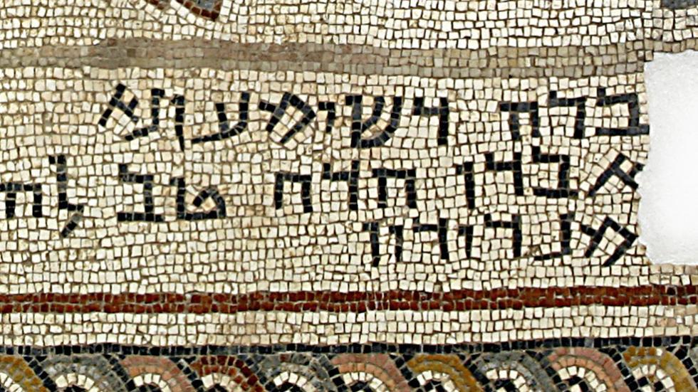
Clear evidence of resettlement appears around the end of the second century or in the early third century CE, when the village enjoyed another period of prosperity into the third and early fourth centuries. A “Galilean”-type synagogue with finely carved architectural elements of white limestone was built in the center of the village during the first half of the third century CE and then was severely damaged in the second half of that century. It was restored shortly thereafter with a magnificent mosaic floor, but the restored building generally lost the splendid architectural appearance that had characterized its first phase. These data are of special importance in light of the debate regarding the date of Galilean”-type synagogues, since both phases of our synagogue are clearly dated to the Roman period, before the rise of imperial Christianity. The finds demonstrate that the architectural tradition of the“Galilean”-type synagogue indeed goes back to the Roman period, at least to the third century, and did not emerge only in the Byzantine period, as some scholars claim.


Archaeological evidence for a severe decline in the settlement surfaces in the mid-fourth century, when most of the village was abandoned. The latest stratified remains at the site date to the last decades of the fourth century, and village life seems to have ceased entirely at the end of that century or in the early fifth.

